Publication Details
General information
Geo-referenced flight path estimation based on spatio-temporal information extracted from aircraft take-off noise.
1.871
Abstract
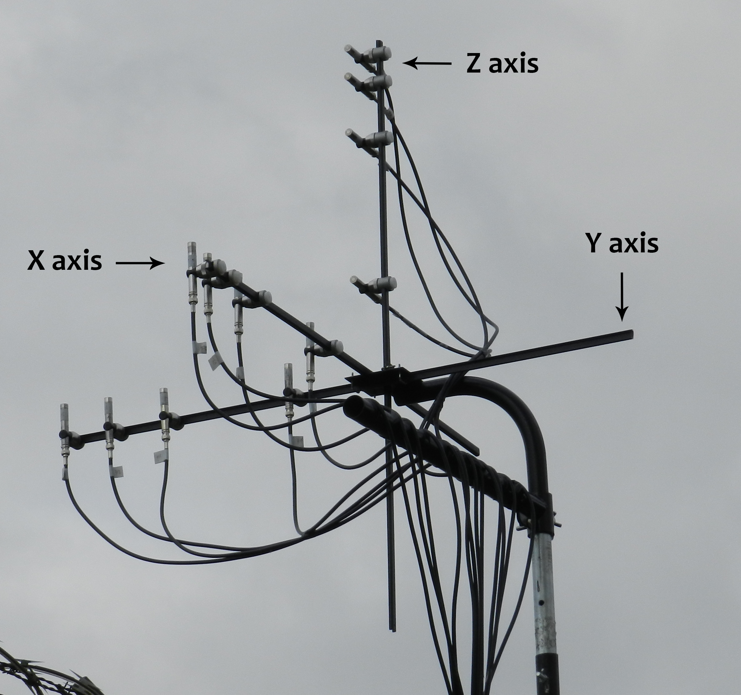 The closer proximity between airports and residential areas has created a growing attention regarding noise pollution. The noise abatement procedures established by the aeronautical authorities and the models for computing noise contours around airports are proof of that. There are also models for identifying aircraft taking off which have focused on the correlation between the aircraft position and the noise signal. However, this correlation has been made so far without spatial information. The present study proposes a method to estimate the geo-referenced flight path followed by an aircraft taking off, using the spatio-temporal information extracted from the noise signal and improved with a smoothing algorithm. A microphone array with twelve sensors is used in order to evaluate different sensor spacings and the spatial aliasing effect when working with take-off noise signals. The flight path estimation method assumes that the aircraft is following a ground track collinear to the runway and was compared against radar information and Automatic Dependent Surveillance-Broadcast (ADS-B) data. The average method accuracy was between 3 and 6 metres. The estimated flight path has a ground length of about two kilometres, including locations at least one kilometre apart from the measurement point.
Full Content
Highlights and contact
Connect With Us


Find us and share with us your comments, questions and requests via social networks.
Newsletter Signup
Find out all group news and updates by subscribing to our website.